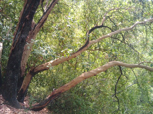
Today we did the Bay Area Hiker's site featured hike for Uvas Canyon County Park.
We started off on Alec Canyon trail. This was a steady moderate climb back and forth thru some switchbacks for about 2/3 of a mile. This is a wide trail with plenty of shade, and park bench with a great view for a quick rest. At the 0.7 mile mark, we took a sharp right turn onto Contour trail. Contour trail is a shady single track with a nice layer of leaf litter covering most of the trail. Contour trail meanders up and down - mostly up but not as steep as Alec Canyon trail. As mentioned in the BAHiker guide, there is a steep drop to the right side for most of this trail, but there were only a few times where it was uncomfortably narrow. It might be somewhat more scary if the ground were wet and loose.
The first part of the hike was very quiet - We did not run into another group of hikers for almost two miles at the beginning of our hike. It started to get busier as we got to the bend where Contour trail meets Swanson Creek. As we started following the creek down, shortly after the bend there was a great spot to stop and have a snack; a large flat rock in the middle of the creek, surrounded by small waterfalls.
Swanson Creek apparently runs all year; in late August without any rainfall in recent memory, the creek was running - not much, but enough to power the many small waterfalls that cascade down this mountain creek. Once Contour Trail hits the creek, the trail heads mostly downhill for the remainder of the journey. Through this area there are some fairly steep sections, but the steepest sections have makeshift steps. The trail widens a bit through this stretch, and comes up on Upper Falls - there is a nice area to watch the falls from the base, or you can play around at the top. Right near the base of Upper Falls, a short trail heads off to the left up to Basin Falls.
Basin falls was also still running even in this dry season, with a nice pool collecting the trickling falls. Back to the main trail, and a little further down was another trail leading off to the left which led to Black Rock falls. This one was not much to look at in dry August.
Back to the main road, we chose to take the southern part of Waterfall Loop trail back towards the trailhead. This trail stays close to the creek and eventually meets back up with the Waterfall Loop Fire Road. We deviated slightly from the featured hike - there was a branch to the left near where we originally split off on Alec Canyon road, signed as Swanson Creek Trail. Down this trail were a few more nice falls. We crossed over a road and headed back down Swanson Creek Trail, which continues to closely follow the creek. A short walk later, this trail intersects a cutoff trail that heads back up to the parking area which is right up the hill. Apparently, this trail continues on for a while longer, to where Swanson Creek empties into Uvas Creek, where there is another set of nice waterfalls - we will target that for next time!
Upsides: Near a running creek even in the summer, beautiful waterfalls, first half of trail very quiet, long but easy drive
Downsides: Only a few trails, main loop only about 3.2 miles, the water and moisture makes for more bugs, more trail traffic with young kids along waterfall loop
We will definitely return to this park in the wetter seasons to see the waterfalls and creeks going full force!


No comments:
Post a Comment